South Africa is preparing for severe thunderstorms, heavy rainfall, hail, and strong winds on Monday, September 7, 2026. These weather conditions are expected to bring winds exceeding 40km/h, along with stronger gusts, large amounts of hail, and excessive lightning across various regions. The anticipated weather system poses a significant risk to several provinces, prompting widespread warnings and advisories from meteorological authorities. The full forecast indicates a dynamic and potentially hazardous day for much of the country, with varying degrees of severity predicted across different geographical areas.
The potential impacts of the storms include localised flooding of roads and informal settlements, which could lead to major traffic disruptions. Authorities warn of possible structural damage, fallen trees, and widespread power outages as a result of the anticipated severe weather. These potential consequences show the importance of public vigilance and adherence to safety guidelines throughout the day. The combination of strong winds and heavy precipitation creates a high-risk environment for both infrastructure and personal safety, necessitating careful preparation and caution from residents.
SAWS Issues High-Level Warnings
The South African Weather Service (SAWS) has issued an Orange Level 6 warning for severe thunderstorms expected across various regions. This high-level alert signifies a substantial risk of disruptive weather phenomena. These conditions could bring significant rainfall, with between 30mm and 50mm possible in affected areas. Such rainfall amounts can quickly overwhelm drainage systems, leading to flash floods, particularly in low-lying areas and informal settlements where infrastructure may be less strong. The intensity of these storms is also expected to manifest in large amounts of hail, which can cause damage to crops, vehicles, and property, as well as excessive lightning, posing a threat to both people and electrical systems.
In addition to the Orange Level 6 warning, SAWS has also issued a Yellow Level 2 warning for parts of the North West and Free State provinces, including areas along the Lesotho border, anticipating localised flooding and strong winds. This Yellow Level 2 warning indicates a moderate likelihood of impacts, but still requires residents to be prepared for potentially disruptive conditions. The strong winds associated with this warning could lead to minor structural damage and make driving conditions hazardous. Residents in these interior areas have been urged by SAWS to take necessary precautions, such as securing loose outdoor items, avoiding non-essential travel during peak storm periods, and staying informed through official weather updates. The SAWS warnings highlight the broad geographical impact of the anticipated weather system, with different levels of alert for distinct regions, reflecting the varied intensity of the expected conditions across the country.
Specific temperature forecasts indicate varying conditions across the country. Kimberley, in the Northern Cape, is expected to experience temperatures ranging from 11°C to 22°C, with severe thunderstorms possible in the eastern parts of the province. Further south, George in the Western Cape is forecast to have temperatures between 11°C and 27°C, though most of the Western Cape is expected to be warm and sunny, contrasting with the more severe conditions elsewhere. The warnings highlight the broad geographical impact of the anticipated weather system, with different levels of alert for distinct regions, reflecting the complex meteorological patterns at play.
Regional Weather Forecasts and Temperatures
Gauteng is expected to be cloudy and cool, with scattered showers and thundershowers forecast across the province. These conditions are likely to contribute to the risk of localised flooding, particularly in urban areas with extensive impervious surfaces. Temperatures in Johannesburg are anticipated to range from 10°C to 14°C, indicating a distinctly cool day for the metropolitan area. Meanwhile, Pretoria will see highs between 13°C and 16°C, experiencing similar cool and damp conditions. Soweto is projected to experience temperatures from 11°C to 15°C, with residents advised to be prepared for the possibility of disruptive weather. The scattered nature of the showers and thundershowers means that while some areas may experience heavy downpours, others might see lighter precipitation, but the overall risk remains elevated.
The Free State is forecast to be overcast, cool, and wet, with a risk of heavy rainfall, particularly over its central and eastern parts. This poses a significant threat of localised flooding and strong winds, aligning with the Yellow Level 2 warning issued for parts of the province. Bloemfontein's temperatures are expected to be between 10°C and 19°C, making for a chilly and damp day. Welkom will see a range of 12°C to 19°C, suggesting slightly milder conditions than the provincial capital but still within the cool spectrum. Bethlehem is predicted to have cooler conditions, with temperatures from 9°C to 13°C, indicating that residents in this eastern Free State town should prepare for a particularly cold and wet day. The persistent rainfall and cool temperatures will require residents to take extra precautions against the elements.
The North West province will experience cool conditions, widespread rainfall, and moderate to strong winds. These conditions are consistent with the Yellow Level 2 warning for localised flooding and strong winds that has been issued for parts of the province. Mahikeng is forecast to have temperatures between 14°C and 20°C, indicating a cool but not excessively cold day. Rustenburg is expected to see temperatures ranging from 13°C to 19°C, with residents advised to be aware of the potential for heavy showers and gusty winds. Potchefstroom will have similar conditions, with temperatures from 12°C to 19°C, placing it firmly in the cool and wet category. The widespread nature of the rainfall and wind across North West notes the broad impact of the approaching weather system on this region, potentially affecting travel and outdoor activities.
Further Provincial Outlooks
KwaZulu-Natal is forecast to experience cold to cool conditions, accompanied by widespread rain and scattered thundershowers. This combination of factors increases the risk of localised flooding, especially in vulnerable areas. Temperatures in Durban are expected to range from 16°C to 21°C, providing a relatively cool and wet day along the coast. Meanwhile, Pietermaritzburg will see conditions between 8°C and 18°C, suggesting a colder day for the inland provincial capital. Ladysmith is projected to have temperatures from 9°C to 16°C, indicating that residents in the interior of KwaZulu-Natal should be prepared for significantly colder and wetter weather. The widespread nature of the rain and thundershowers means that all parts of the province could be affected, requiring vigilance from residents.
In Limpopo, conditions are anticipated to be partly cloudy to cloudy with isolated showers. While not as severe as other provinces, these isolated showers could still contribute to localised wet conditions. Polokwane's temperatures are forecast to be between 12°C and 18°C, suggesting a cool but not overly cold day. Musina is expected to reach 17°C to 23°C, indicating slightly warmer conditions further north in the province. Residents should still be mindful of the possibility of sudden downpours, even if widespread severe weather is not predicted.
The Eastern Cape will experience cool conditions, with scattered showers predicted both inland and along the coast. This suggests a generally damp day across the province, though the intensity of rainfall may vary. Gqeberha is expected to have temperatures ranging from 15°C to 23°C, offering relatively mild conditions despite the scattered showers. East London will see conditions between 16°C and 21°C, with coastal areas potentially experiencing some wind alongside the rain. Residents in both urban and rural areas should prepare for cool and showery weather.
The Northern Cape's weather conditions will vary from cold to warm, showcasing the province's vast geographical diversity. Severe thunderstorms are possible in the eastern parts of the Northern Cape, aligning with the broader severe weather warnings for the interior. These storms could bring heavy rainfall, hail, and strong winds to areas like Kimberley, where temperatures are expected to be between 11°C and 22°C. Conversely, western areas of the province, including Upington, where temperatures are forecast to range from 12°C to 27°C, are expected to remain sunny and dry, providing a stark contrast to the eastern regions. This notes the localised nature of some of the more severe weather phenomena.
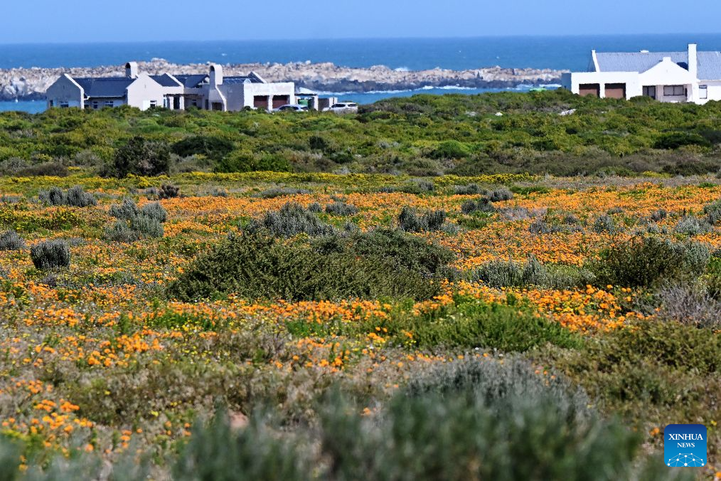
Most of the Western Cape is expected to be warm and sunny, offering a reprieve from the challenging conditions forecast for other parts of the country. However, a Yellow Level 2 warning for damaging winds remains in effect for the south-western coast, indicating that coastal residents should still exercise caution. Cape Town is expected to experience temperatures ranging from 15°C to 29°C, suggesting a warm day with potentially strong winds along the coast. George is forecast to have temperatures between 11°C and 27°C, with generally pleasant conditions despite the broader national warnings.
Safety Precautions Advised
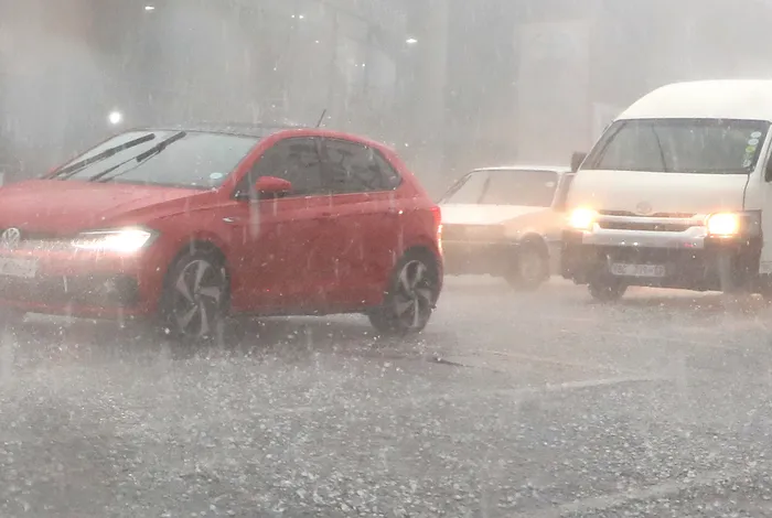
Residents are advised to avoid crossing low-lying bridges and exercise extreme caution when traveling during heavy rainfall and thunderstorms. These areas are particularly susceptible to flash flooding, which can quickly become dangerous. Motorists should remain alert to changing road conditions, particularly where heavy rainfall may cause flooding and reduce visibility. It is key to reduce speed, increase following distances, and be prepared for sudden changes in weather and road surfaces. Securing loose outdoor items such as garden furniture, trampolines, and refuse bins is also recommended to prevent them from being carried away by strong winds and potentially causing damage or injury. Staying indoors during the peak of severe weather, especially during excessive lightning activity, is the safest course of action. Following official weather updates from SAWS and local authorities is critical for staying informed and making timely decisions to ensure safety.